Detroit River-Western Lake Erie Basin Indicator Project
Hexagenia Density and Distribution in the Detroit River
Larval Distribution, 2004
The entire Huron-Erie Corridor was sampled in 2004. A suite of 20 randomly-selected locations sampled in July and August 2004 produced a distributional pattern similar to that observed in 1968 (Ciborowski et al. 2006; Figure 6). However, this was partly due to the timing of sampling. In 2004, many samples were collected in July after the period of maximum emergence, but before nymphs representing the next generation had hatched from their eggs. Densities were moderate or high in much of Lake St. Clair and lower reaches of the St. Clair River (Figure 7).
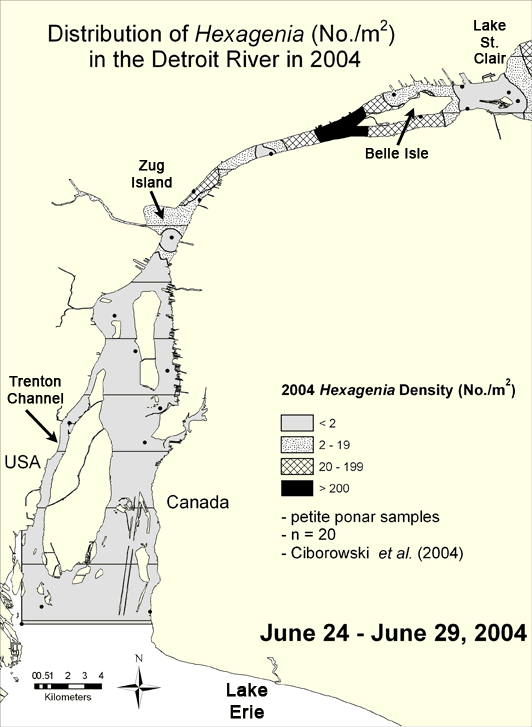
Figure 6. Density of Hexagenia in the Detroit River in 2004 interpolated from data compiled from Ciborowski et al. (2006). Areas containing fewer than 20 nymphs per square meter indicate either degraded benthic conditions (if sediments are soft) or unsuitable habitat for mayflies (if sediments are hard). Map by Anita Kirkpatrick.
Go to full text of Hexagenia Density and Distribution in the Detroit River
Go to the next map, Distribution of Hexagenia in 2004/2005 in the Huron Erie Corridor